Ryan Marino earns rank of salutatorian at Stissing Mountain

Ryan Marino is salutatorian of the Pine Plains Class of 2020. Photo submitted

PINE PLAINS — Between his formative and final years as a student in the Pine Plains Central School District, Ryan Marino has always thought of his school district as “one big family,” and it was with great pleasure that he learned he was this year’s salutatorian. Ryan spoke highly about the district and how its programs have helped him thrive.
“People bash the school for being small and for being in the middle of nowhere,” he said, “but I think it’s one of the better schools in the county.”
Taking advantage of all opportunities in the district, Ryan’s interests span a wide range of academic and athletic extracurriculars. With a racket in hand, he joined the Pine Plains varsity tennis team in the seventh grade and remained an active member until the team was disbanded due to low participation. Starting in the fourth grade, he played saxophone in the Pine Plains Band, and he competed on the junior varsity soccer team for a couple years. Joining the district’s Math Honor Society during his sophomore year at Stissing Mountain, Ryan was later promoted to vice president and then president. Above all, he sought to get involved in his class, whether that meant helping out at the annual Senior to Senior Breakfast or putting together a booth for the Pine Plains FFA’s Annual Fall Agricultural Festival.
“I’m not looking for any praise for it,” Ryan said. “I’m doing it because I like doing it and I love my friends.”
Reflecting on his high school career, Ryan shared fond memories of watching his friends compete on the basketball court, attending football games and making friends during his time on the tennis team.
Considering how the coronavirus pandemic has shaped his class’s path to graduation, he said that while the health crisis might have disrupted their senior year and prevented them from enjoying the annual traditions and ceremonies, he feels that this “historic pandemic” has helped push both himself and his class forward. Rather than reflect on what they missed out on, he chose to reframe the pandemic as a reflection on resilience and preservation as well as a true test of his character.
“I think it really goes to show how great our class really is and how they pushed forward,” Ryan said.
As plans for graduation take shape, Ryan is preparing to say goodbye to the district that’s guided his success and the classmates he’s grown familiar with over the last 13 years.
“These are people I have known the majority of my life,” he said, “and I’m going to miss them.”
Come August, Ryan will be studying mechanical engineering at Rochester Institute of Technology.His future plans include pursuing a career in the automotive industry.
The following excerpts from The Millerton News were compiled by Kathleen Spahn and Rhiannon Leo-Jameson of the North East-Millerton Library.
January 24, 1935
About Millerton
Mayor and Mrs. William J. Brewer and Mr. and Mrs. Miles Jenks left on Monday for a month’s vacation in Florida.
Mr. Roy Ganung and daughter, Jane, spent Tuesday afternoon In Poughkeepsie.
Jean Silvernale is confined to home by illness.
Miss Blanche Bates is spending several weeks at the home of her brother, Edward Bates, at Pittsfield, Mass.
George Wooding of Thornewood spent Sunday at the home of his sister, Mrs. Harry Card.
Mr. and Mrs. Lewis Decker and family moved to Lakeville on Sunday.
January 22, 1976
Snowmobiles Tresspassing[sic], Officer Says
Trespassing and riding on public roads are the major offenses committed by area snowmobilers this winter, New York State Conservation Officer Harry Wheeler stated this week.
He asserted that a number of snowmobile riders have been sighted traveling on public roads and soaring across private property without permission, both illegal acts.
January 18, 2001
Local Homes Added to Historic Register
COLEMAN STATION — Three houses in the town of North East were recently added to the National Register of Historic Places.
The Oliver Barrett House, the Dakin-Coleman Farm and the Thomas Wheeler Farm, all located in the Coleman Station area, were selected by the New York state Office of Parks, Recreation and Historic Preservation to be listed individually on the register, though the entire Coleman Station Valley was considered for the recognition in 1993.
Millerton Sees Some Business Changes; Shops Move, Expand
MILLERTON- Two stores on Main Street in Millerton have interior changes in the works.
Leslie Hoss Flood has recently relocated her Amenia-based store to the basement of the Millerton Antiques Center. Ms. Flood’s shop had been in Amenia for about 15 years, where, in addition to selling used and antique furniture, Ms. Flood also ran an upholstery shop.
After removing several partitions and installing new lights, the basement store looks entirely new. Ms. Flood is pleased with the space, which offers more room in which to showcase her wares. She is also taking advantage of the additional area by creating a separate reupholstery room and a section to display in-stock fabrics.
Pasta-At-Large Expands
After acquiring the empty space, owner Sofia Okołowicz has expanded her business to provide “a little more elbow room inside.”
The front portion has been open since late November and, in recent days, Ms. Okolowicz has removed a wall and had electricity installed in the new area.
The college-age generation is grappling with inflation, increasing housing prices, climate change, and now mass corporate layoffs. In a world where geopolitical turmoil is increasing, the ground beneath their feet is shifting. Many believe their future is bleak.
My nephew, Joey, just got married. His wife lives with her parents, and he lives with his. While he makes good money as a pharmacy manager at a national chain drugstore, neither he nor his wife can afford even a down payment on a house in Long Island. They are moving in with the wife’s parents. Joey’s sister is also married with two children. They also live with their parents. Welcome to the American dream turned nightmare for almost 70 million young Americans.
The typical age range of Gen Z is 1997 to 2012. They are the demographic cohort succeeding Millennials and preceding Generation Alpha. They are the most racially and ethnically diverse generation in America, with 48% being non-white.
Almost all of this generation is highly active on social media. Almost 60% are planning to pursue a college education. They are just as likely to identify as Republicans, Democrats, or Independents. As such, the present populist upheaval the U.S. is undergoing takes an inordinate toll on them. It may be why 91% of Gen Zers report experiencing symptoms of stress and anxiety.
While Wall Street opened the year celebrating the promise of a bright future, thanks to AI. Opinion leaders predict that artificial intelligence, robots, and space, among other technological breakthroughs, will dramatically reshape the way the world works. For college grads, all they see is a no-fire, no-hire labor market where unemployment among workers ages 20 to 24 continues to rise. It is now to 5.3% and even worse for those younger than that.
The National Association of Colleges and Employers predict the entry-level hiring crisis will worsen this year, rating job prospects as poor or at best fair. At a recent gathering of employers at the Yale School of Management, 66% admitted they planned to cut jobs or freeze hiring.
With an economy that is expected to grow by 3% in 2026, one would have expected the opposite reaction, but then you would not be reckoning with the impact of artificial intelligence on the job market. Potential employers are concerned and uncertain about how AI might reshape the workforce over the next few years, and rightfully so.
Most analysts believe that many white-collar positions, especially at the entry level, will be replaced by technological advancement. Underscoring that concern, many corporate giants, including Amazon, UPS, Target, and Google, announced layoffs affecting more than 60,000 jobs. And to many, that is just the tip of the iceberg.
Faced with taking fast-food jobs at minimum wage and lacking work experience in their hoped-for professions, 3 in 5 Gen Z workers are looking elsewhere for a job with some kind of reasonable future. Almost half of these young workers believe the blue-collar jobs may offer better long-term security than corporate work in the technology fields. The top sectors pursued by Gen Z include plumbing, automotive repair, construction, and electrical work.
I happen to agree with that belief, but unfortunately, Gen Z applicants face the same barrier to entry in their white-collar arena—lack of experience. Many job applicants, regardless of industry, are now required to have at least 3 years of experience and up to 5 years before being considered.
The lure of six-figure salaries in the blue-collar area is attracting more Gen Zs to vocational schools. However, what many conveniently forget is that earning that kind of take-home pay requires years of experience, a substantial investment in personal tools and equipment, and serious wear and tear on the body.
As I write this, in the next room, a 65-year-old builder I’ll call Scott, who is going in for his second knee replacement next month, is building another room in our condo. Assisting him is a young GenZer. There is a constant stream of chatter as Scott talks through his drywalling process. His helper listens intently. They seem eager to learn and ask questions as they work. He did the same when he placed the struts and erected the wall.
For several years, Scott has been involved in a local high school program that teaches vocational school grads his business, while they gain on-the-job experience and a paycheck. Scott and others like him are providing a solution one day at a time. He is one answer to the dilemma facing this struggling generation. This country needs more Scotts to hire and teach a young workforce in need.
Next week, I will highlight one area where many Gen Xers have found an alternative to home ownership. It holds risks but doesn’t cost an arm and a leg to get involved.
Bill Schmick is a founding partner of Onota Partners, Inc., in the Berkshires.Bill’s forecasts and opinions are purely his own and do not necessarily represent the views of Onota Partners, Inc. (OPI).
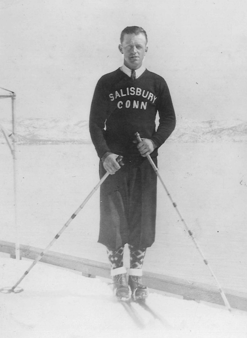
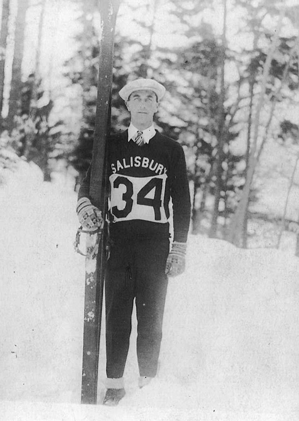
John Satre, one of the original Satre brothers, is credited with pioneering the sport of ski jumping in the United States.
SALISBURY, Conn. — Salisbury’s longstanding tradition of ski jumping is reaching new heights this year with the 100th annual Jumpfest, scheduled for Feb. 6–8 at Satre Hill.
The weekend-long celebration opens with a community night on Friday, Feb. 6, followed by youth ski jumping competitions and the Salisbury Invitational on Saturday. The event concludes Sunday with the Eastern U.S. Ski Jumping Championships.
While spectators look skyward to watch the high-flying athletes, Jumpfest will also invite the community to look back on Salisbury’s deep-rooted ski jumping history.
Ski jumping originated in Norway in the 19th century and is a tradition familiar to most Nordic children. That was the case for the five Satre brothers — John, Magnus, Ottar, Sverre and Olaf — who grew up competing in ski jumping and cross-country skiing.
When John Satre moved to Salisbury in 1923 to work as a chauffeur, he brought the tradition with him. The rolling hills and heavy winters of the Northwest Corner resembled those of Norway, allowing John to seamlessly integrate his passion into his new community.

Within a year, his brothers followed him to Salisbury.
In 1926, John Satre captivated roughly 200 spectators by skiing off a snow-covered barn roof.
The brothers soon formed the Salisbury Outing Club — now known as the Salisbury Winter Sports Association (SWSA) — and began construction of a permanent ski jump in the same location it sits today: Satre Hill.
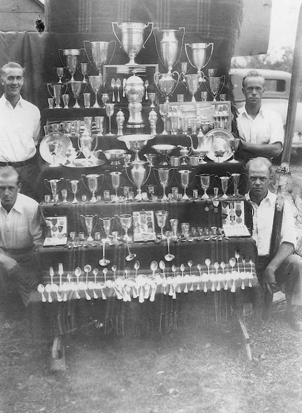
By 1933, the Satre brothers had won numerous championships and helped popularize the sport across the United States. Salisbury hosted the U.S. Olympic Trials in 1932, and the following year hosted the National Championships.
Tragically in 1934, at the age of 40, John Satre was killed in a car accident. The New York Times hailed him as a pioneer in U.S. skiing and his legacy is carried on in the winter sports culture that is nurtured in Salisbury today.
During this time, local children were introduced to the sport, creating makeshift jumps in their backyards out of crates and hay bales. One of these children was Richard Parsons, who became the first Salisbury resident to earn recognition for cross country skills. He earned a spot for the 1932 Lake Placid Winter Olympic Games and in 1936 competed in the Winter Olympics in Garmisch, Germany, where he was the leading American-born cross-country skier.
During World War II, young athletes who would have normally been jumping were enlisted in the service, causing a lull in the sport and deterioration of the jump itself. After the war, however, community members eagerly worked to rebuild the jump, and another Salisbury athlete emerged.

Roy Sherwood was first introduced to ski jumping when his father built him and his brother their own ski jump in their backyard. Sherwood quickly gained ground, earning himself the title of “hometown hero.” By 1954, Sherwood was offered a spot on the U.S. Olympic Team for the 1956 games in Cortina, Italy.
Sherwood’s path to the Olympics was far from easy. A year before the Games, he was diagnosed with polio, threatening his ability to compete. He recovered enough to travel to Italy, only to hit an icy patch during a practice run.
Sherwood rebounded and competed the next day, placing 36th out of 51 — the second-highest finish by an American — and was later inducted into the U.S. Ski & Snowboard Hall of Fame.
Today, four jumps line Satre Hill — K10, K20, K30, and K65. The 65-meter jump is used for competitions, and the smaller jumps are used to teach local youth during winter camps.
Islay Sheil, a Housatonic Valley Regional High School student and Lakeville resident, is the current SWSA athlete on the rise in ski jumping today. Her passion for the sport emerged during one of the SWSA winter camps, and last March earned gold in the Junior National Championships. The next Junior National Championships will be hosted in Salisbury in 2027.
While Salisbury celebrates the 100th anniversary of its own ski jump this year, the Olympic Games will be held in Milan and Cortina, Italy, the same place that Sherwood gained global recognition.
To honor the town’s remarkable history and tradition of ski jumping, Jumpfest will begin early with a Winter Warmer on Jan. 31 between 5:30 to 8 p.m. It will be at the home of Salisbury First Selectman Curtis Rand. Small plates and drinks will be served. Limited tickets are available for $50 and more details can be found at Jumpfest.org/100years/

On Feb. 1, a double feature screening of On the Hill and Downhill Racer will be held at The Moviehouse in Millerton, followed by a panel discussion on winter sports and SWSA’s role in Salisbury’s history. There will also be a raffle and SWSA merchandise for sale.
Tickets for the showing are $16 and details can be found at Jumpfest.org/100years/.
On Friday, Feb. 6, Jumpfest will host community night at Satre Hill. SWSA will offer free admission for the night. Gates open at 6 p.m. and “Target Jumping Under the Lights” will begin at 7 p.m. There will be fireworks sponsored by NBT Bank, bonfires, and food and drinks available for purchase. The Human Dogsled Race is set for 8:30 p.m. Teams of five can register at Jumpfest.org
On Saturday, Feb. 7, the Junior Competition on K20 jump will begin at 9 a.m. The Salisbury Invitational Ski Jumping Competition will practice from 11 a.m. to noon and compete at 1 p.m. Community members are invited to the Snow Ball at the Lakeville Town Grove at 8 p.m. Dancers will be accompanied by live music from the Steve Dunn Band. Entrance to the Ball is $20 with children 12 and under free of charge.
On Sunday, Feb. 8, Satre Hill will hold the Eastern U.S. Ski Jumping Championships. Athletes will practice between 11 a.m. to noon and compete at 1 p.m.
Willie Hallihan of SWSA explained that the length of time and number of people involved on an emotional level has made the sport “iconic to Salisbury.”
Hallihan recounted in the PBS documentary “The Jump” that the ski jumps are “like a family member to a lot of people”.