CCE Gardeners resign amid leadership concerns

Master Gardeners Heather Brenner, Joyce Tomaselli and Philomena Kiernan worked the 30th annual Master Gardener plant sale in Millbrook on May 19 and 20, 2023.
Judith O’Hara Balfe

Master Gardeners Heather Brenner, Joyce Tomaselli and Philomena Kiernan worked the 30th annual Master Gardener plant sale in Millbrook on May 19 and 20, 2023.
MILLBROOK — The Dutchess County Master Gardener Program at the Cornell Cooperative Extension Ductchess County (CCEDC) experienced a mass resignation of its volunteers in late March.
This departure comprises at least half of the program’s 74 members, some of whom have been in the program for decades.
The Master Gardener Volunteer Program is a national initiative of Cornell University: trained volunteers collaborate with county Cooperative Extension offices to provide research-based guidance to home gardeners and youth.
Originating in Washington state in 1972, Dutchess County pioneered New York State’s involvement in 1975. Today, Master Gardener programs exist in 46 states, with over 23,000 participants nationwide, including more than 1,100 in New York State alone.
The primary grievances of the resigned volunteers from Dutchess County revolve around perceived poor management practices by the program’s new directors. Allegations include the creation of a hostile work environment, arbitrary dismissals and suspensions of Master Gardeners, and a lack of transparency regarding changes to volunteer commitments.
“There is something called a conflict resolution policy at the extension, and they would never let us utilize it to hear why we were upset, what we thought we could do about it, and how we could fix things and so forth. They just wouldn’t sit down with us,” said a master gardener who prefers to remain anonymous. She went on to say, “They never thought about the repercussions. Period. And quite honestly, they don’t seem to care.” This sentiment is echoed by others who feel that the current management team has failed to address their concerns and engage in meaningful dialogue.
The imposition of new rules and requirements without adequate explanation has contributed to the discontent among volunteers. Recent developments, such as what the gardeners describe as restrictive volunteer forms and disrespectful language, have also raised concerns among volunteers.
The departure of these longtime volunteers represents a significant loss for the Dutchess County Master Gardener Program and the community it serves.
Said Chris Ferrero, Master Gardener and one of the founders of the Master Gardener Speaker’s Bureau, “The Master Gardeners need to be brought back if we are going to serve the community. If we can’t, why is the county paying the extension for this service?”
Moving forward, there is a collective hope among former volunteers for a reversal of the program’s current trajectory which they perceive to be marked by inflexible and disrespectful management practices. The volunteers have voiced their concerns in an open letter about the future direction of the program and its ability to effectively serve the community.
Asked for comment, CCEDC Director Mary Lou Carolan acknowledged that a number of volunteers had left the program. She said that the movement among the Master Gardeners had started last summer, following the implementation of revised policy guidelines from Cornell’s horticulture program.
The revised guidelines required Master Gardeners to spend more hours training, so that those with the Master Gardener title would be more educated in all aspects of plant management, from propagation to soil science on down, said Carolan — the idea being that the Gardeners can then pass that information on to the public.
She said that the Master Gardeners who left had objected to new requirements of time spent in the labs and greenhouses, learning, for example, how to manage cuttings and propagate plants.
The Master Gardeners also objected to requirements to staff the CCEDC horticulture hotline, which people call with questions about gardening, Carolan said. This also required training, such as how to research the answers to questions that the volunteer might not know off the top of their heads.
The changes coincided with changes in leadership and staffing, said Carolan.
“With new leadership comes new direction, new vision,” she said. “I think they didn’t want anything to change.”
Millerton News
Legal Notice
Notice of Filing
Completed
Assessment Roll with Clerk
Notice is hereby given that the Final Assessment Roll for the Town of Pine Plains in the County of Dutchess for the year 2026 has been completed by the undersigned assessor, and a certified copy is filed in the office of the town clerk on the 1st day of July, 2026, where the same will remain open for public inspection by appointment during normal business hours.
Assessor for the Town of Pine Plains Sara Foglia
06-25-26
Legal Notice
Notice of Formation of Kaits Kleaning LLC. Art. Of Org. filed with SSNY on 05-22-2026. Office Lo-cation: Dutchess county. SSNY designated as agent of the LLC upon whom process against it may be served. SSNY shall mail process to: 24 Attlebury Hill Road, Standfordville NY 12581.
06-04-26
06-11-26
06-18-26
06-25-26
07-02-26
07-09-26
NOTICE OF COMPLETION
OF FINAL ASSESSMENT ROLL
NOTICE IS HEREBY GIVEN THAT THE FINAL ASSESSMENT ROLL FOR THE TOWN OF AMENIA, COUNTY OF DUTCHESS, FOR THE YEAR 2026, HAS BEEN COMPLETED BY THE UNDERSIGNED ASSESSOR, AND A CERTIFIED COPY IS FILED IN THE OFFICE OF THE TOWN CLERK OF AMENIA, 4988 ROUTE 22, AMENIA, NY, ON THE FIRST DAY OF JULY, 2026, WHERE THE SAME WILL REMAIN OPEN FOR PUBLIC INSPECTION. A COPY OF SUCH WILL BE AVAIL-ABLE ONLINE AT AMENIANY.GOV
DATED THIS 1ST DAY OF JULY, 2026.
DONNA DIPIPPO ASSESSOR
TOWN OF AMENIA
845-373-8118 x 104
06-18-26
06-25-26
Millerton News
Isabella Freedman Jewish Retreat Center is a year-round 120-person retreat facility that is located in Falls Village, CT. Want to work at a beautiful, peaceful location, with great people? This is the place to be!We are currently seeking positions for Seasonal Lifeguard(s), Cook, Retreat services associate (banquet server front of house) and Mashgichim (F/T or P/T) for our summer season. For more details please visit our website at Careers - Adamah or email a copy of your resume to rebecca.eisen@adamah.org
Old Houses and Barns my specialty: Renovations and Re-pairs. 25 years serving the tri-state area. Licensed and Insured. Based in Canaan, CT. David Valyou 917-538-1617. davidvalyou@yahoo.com
Looking for a small farm to board my 22 year old mare ideally located near trails. She gets along well with other horses. No drama. Available to help with feeding and or turnout if needed. 860-786-2546.
PUBLISHER'S NOTICE: Equal Housing Opportunity. All real estate advertised in this newspaper is subject to the Federal Fair Housing Act of 1966 revised March 12, 1989 which makes it illegal to advertise any preference, limitation, or discrimination based on race, color religion, sex, handicap or familial status or national origin or intention to make any such preference, limitation or discrimination. All residential property advertised in the State of Connecticut General Statutes 46a-64c which prohibit the making, printing or publish-ing or causing to be made, printed or published any notice, statement or advertisement with respect to the sale or:rental of a dwelling that indicates any preference, limitation or discrimination based on race, creed, color, national origin, ancestry, sex, marital status, age, lawful source of income, familial status, physical or mental disability or an intention to make any such preference, limitation or discrimination.
2 Bedroom House. Millerton, NY. Quiet. 4 miles from town.$2500 monthly, plus utilities. 518-567-8277.
Estate Sale. Rain or Shine. July 3, 4. 9-5. 1011 Crossroads to Canaan Valley Road New Marl-borough, MA 01259.
Nathan Miller

Kanchisar Jiradhanaiphat, left, and John Schildbach hope to open Muanjai Tea on Main Street in Millerton by late July.
MILLERTON — Owners of a Thai tea shop planned for Main Street expect to get started with interior renovations this week after receiving approval for septic system plans from health officials.
John Schildbach, who plans to open Muanjai Tea at 28 Main St. in July, said on Monday, June 22, that the shop is awaiting one final approval from the Dutchess County Board of Health on the interior space itself and expects to begin installing counters and seating immediately after.
Discussions with the Board of Health over septic capacity caused earlier delays. Schildbach originally planned to have seating for 20 people inside the shop, but health officials required him to scale back that plan. The shop’s septic system was approved with the condition that only 14 seats be installed inside the shop.
He said the build out will likely take at least three weeks longer, meaning the storefront is not expected to open prior to Millerton’s 175 celebration running from July 11 to July 19. But Schildbach is planning to operate a pop-up tent offering a limited variety of tea drinks during the celebration.
Schildbach also plans to distribute 25% discount coupons to shoppers that stop by the pop-up. Customers can then use those coupons once the shop opens to get a discount at the shop once it opens later in July.
“It’s a little bit of a discount for people who want to try us out,” Schildbach said.
Schildbach announced plans to open the tea shop with his wife, Kanchisar Jiradhanaiphat, in late April. The shop will occupy the storefront formerly occupied by Candy-Os on Main Street.
“This isn’t going to be a bubble tea shop,” Schildbach said in April, describing a menu that seeks to bring authentic Thai tea culture to Millerton.
Highlights will include nom yen — a pink milk tea made with sweetened condensed milk and flavored syrup — as well as coffee cham yen, a blend of coffee and tea. The menu will also feature Thai tea ice cream floats, lattes and matcha drinks.
But the pair don’t want to limit the menu to just desserts and sweets. Schildbach said they are aiming for a sophisticated — yet affordable — menu that offers an authentic, approachable take on Thai tea shops.
That desire for authenticity will be built into the space itself, Schildbach said. Plans for the tea shop include adding a wall to create a service window typical of Bangkok tea shops, accented with tile and wood details.
The goal is to fit in with Millerton’s current lineup of Main Street businesses, while providing a unique experience for locals and visitors alike.
“It’s going to be like you’re in a tea shop in Thailand,” Schildbach said.

Want more of our stories on Google? Click here to make us a Preferred Source.
Joe Brennan

Phil Carroll stands near a pile of cut firewood he prepared for sale across New York. The Amenia native has been cutting trees and splitting wood for fireplaces for decades.
AMENIA — It’s been said that wood, as it burns, tells its history.
Phil Carroll has split and sold countless cords of dry highly flammable firewood over the decades and has narrated a lot of the history of his hometown, Amenia.
Carroll’s story begins more than 80 years ago on the banks of what was once Lake Amenia. Right before Carroll was born in 1942, his brother drowned at that swimming spot at the end of Lake Amenia Road, where the dam used to be. Phil’s mother was furious years later when she caught Phil skating across the frozen lake one winter day.
“She already lost one son to that lake,” Carroll said.
But they didn’t move out of their neighborhood to escape bad memories. Even after the dam broke, draining the lake into swamps nearby and forever changing Amenia’s landscape, his family bought and traded the land, moved houses, improved them, stayed close and planted huge gardens, plowed them over and made their own little community of wood cutters. Everything today is impeccably cared for.
The wood cutting machines are clean but clearly well used. It is a place of steady purposeful work.
Before making his career as a firewood supplier, Carroll worked as a tractor-trailer driver cross country but didn’t like it.
“You can’t sleep in a truck and own a house,” Carroll said. “Anybody who does that I think is crazy. You’re paying for the house and you’re out there.”
Then he got the idea of selling bundles of wood he sourced from his own property and nearby forests. His family thought he was crazy. Nobody around here would pay for kiln-dried firewood so Phil started hauling four-foot lengths of wood south to Fishkill, Clark, and Wilkins, New York, eventually leading to connections to New York City.
He had cleared trees right across the lake, where developer John Lango carved out those homes on Broadway. It was a swamp then, part of the lake. Then he worked to clear the forests behind his house — by the Squabble Hole, where the old ore mine flooded and made a perfect swimming hole. Phil couldn’t swim much, but the town boys dove off a rope halfway up Squabble Mountain.
He focused on distributing his wood Manhattan’s East Side first because storefront owners would pay and he could double park his truck at less risk of $600 tickets. In 1988, walking block to block, store to store, the small bodega owners saved him, and supermarket chain D’Agostinos took half a truckload but couldn’t put a real wood pile in the basement or else risk burning down the borough.
“I used to buy 80 to 90 thousand dollars of wood a year, just for New York,” Carroll said. “I’ve cut that down to 35 thousand now.”
While visiting New York all those decades ago, Carroll fostered an appreciation for dancing at Korean nightclubs. A full day’s worth of driving and delivering firewood would end with a high-energy fete dancing until the clubs closed at 3 a.m. Then Carroll would drive home.
Over the years, Carroll has recruited most of his family to join in on the business, including his son, Phil Carroll Jr.
Phil Jr. turned to the forest at 5 years old to work with his father. His job was marking logs with a 19 inch stick his father gave him, that had been measured and carved out for him as a template. Phil gave Phil Jr. a small hatchet, and not a Davy Crockett rubber blade, a real sharp edge and he marked off each section with a chopped notch as his father came behind him and tore through the felled tree with his chainsaw.
The assembly line begins at the simple splitter. It’s been sitting out in the split log walls around the driveway. These mostly go to the campgrounds like Copake. The air-dried local pieces take a year to cure and do not burn as good as his top-of-the-line stuff. J and J Lumber in Dover Plains bakes 19-inch lengths of various hardwood for a day and a half until its water content is bone dry.
These he splits over and over again so most of the bundle’s individual pieces are small and light enough to be picked up by anyone. The other pieces are even smaller, making for ready kindling although the whole pile will erupt in perfect flame, dry as tumbleweed.
Just look at the design of his signature product: the firewood bundle. It’s got his name on top, easy to read, so the buyer knows he’s getting the real deal from the master. The clear plastic is shrink wrapped so you can see that the wood and bark is clean and dry and free of bugs.
Phil, who still works selling firewood, takes pride in his product, he’s been known to throw a bundle across the workshop, “Who the hell made that!”
And Phil’s tireless, always figuring. As he looks out over his backyard, he’s still thinking ahead. “Next year I’m going to get a guy I know to blow up that other side of the hill,” Carroll said dryly. “I’d have twice as much flat land up here.”
Graham Corrigan
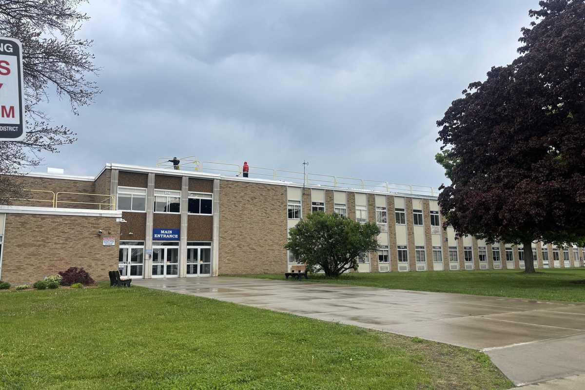
PINE PLAINS — Voters approved a school district budget on Tuesday, June 16, that cut three staff positions to save nearly $300,000 in expenses.
After the initial budget failed in May, Pine Plains Central School District administrators cut expenses to bring the tax levy within the state’s tax cap. Since the revised spending plan complied with the cap, it required only a simple majority for approval.
The second budget passed easily on June 16. The final vote count was 643 votes in favor, and 288 against.
The new budget is $290,569 less than the first budget. The reduction primarily came from eliminating three staff positions — a head bus driver, typist and nurse.
The budget’s passage now means the district will avoid much deeper cuts than what would have been required had it been voted down a second time. The mandatory contingency budget, which would have gone into effect, would have resulted in $945,789 in additional reductions and a freezing of capital projects.
The district has now moved forward with capital plans with the new budget in place. It has announced plans to replace the floor tiles at Seymour Smith Intermediate Learning Center and is continuing repair work on the roof at Stissing Mountain Jr/Sr High School.
The high school’s tennis courts and track will also be resurfaced this summer. Work is expected to begin in late June, and will last until Sept. 1. During this time, Seymour Smith and the affected athletic fields will be closed.
Graham Corrigan
MILLBROOK — The town of Washington is rolling out its summer programming this month, and there’s something on offer for everyone.
The town’s major attraction, the park and pool located at 3774 Route 44, will be open daily starting on June 27, when the pool opens from 12 to 6 p.m. on weekdays and from 11 a.m. to 7 p.m. on weekends. Attendees can access basketball, pickleball, shuffleboard, and volleyball courts, as well as baseball and soccer fields, fishing access, and picnic areas. There are also pavilions available to rent for gatherings of up to 75 people.
Poolside concerts return this year as well. Music from Long Steel Rail, Big Ang, and Johnny Walkers will soundtrack the pool parties on Sunday afternoon throughout the summer.
There’s one major change to the summer offerings: the summer camp program, a popular option for kids and working parents alike, has been extended to include an all-day option. Previous camp sessions were limited to three hours a day — now, camp hours are 9 a.m. to 3 p.m., with early drop-off and late pick-up available as well. Campers can participate in group activities like swimming, athletics, and arts & crafts.
The first of three two-week camp sessions starts on June 29. Registration is open until June 22, or when full capacity is reached.
Want more of our stories on Google? Click here to make us a Preferred Source.
Want more of our stories on Google? Click here to make us a Preferred Source.