Local history through maps revealed in society’s exhibit
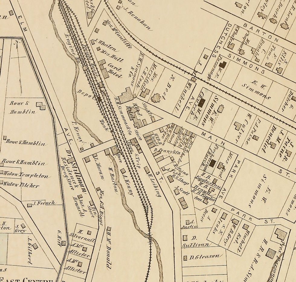
An enlargement of part of the Village of Millerton from a portion of an 1876 map of the Town of North East. Photo submitted

MILLERTON — Go into any historical society’s archives and you will find many ways to document the story of your community — news clippings, books, diaries, business records and photographs.
Another way is through maps, which show not just the geography but also reflect the businesses, transportation networks and families that settled in a particular location.
The North East Historical Society is offering an exhibit through the month of November titled “Understanding Local History Through Maps,” at the NorthEast-Millerton Library, 75 Main St. Representations of a dozen different maps will outline the story of the development of the Town of North East from Colonial times into the 21st century.
The maps include important Sanborn fire insurance maps from the late 19th and early 20th centuries, which show specific businesses in Millerton and reflect how the village grew over time. Other maps show where Indigenous people lived, where the first land patents were awarded by New York’s Colonial British governor, and how the first geopolitical borders of precincts—the predecessors of townships—developed.
After the Town of North East was created as a separate entity in 1788, later 19th-century maps show the impact of the railroads on commerce and the development of the Village of Millerton and the town’s numerous hamlets. Other maps show the terrain and agricultural soils so key to the town’s ability to sustain its agricultural heritage.
In addition, two modern maps show off the town’s two historic districts that are on the National Register of Historic Places as well as on New York’s own registry.
The exhibit is open during library hours from 11 a.m. to 6 p.m. Tuesday through Friday and from 10 a.m. to 3 p.m. on Saturday.
Nathan Miller
The Millerton 175th Anniversary Committee's logo.
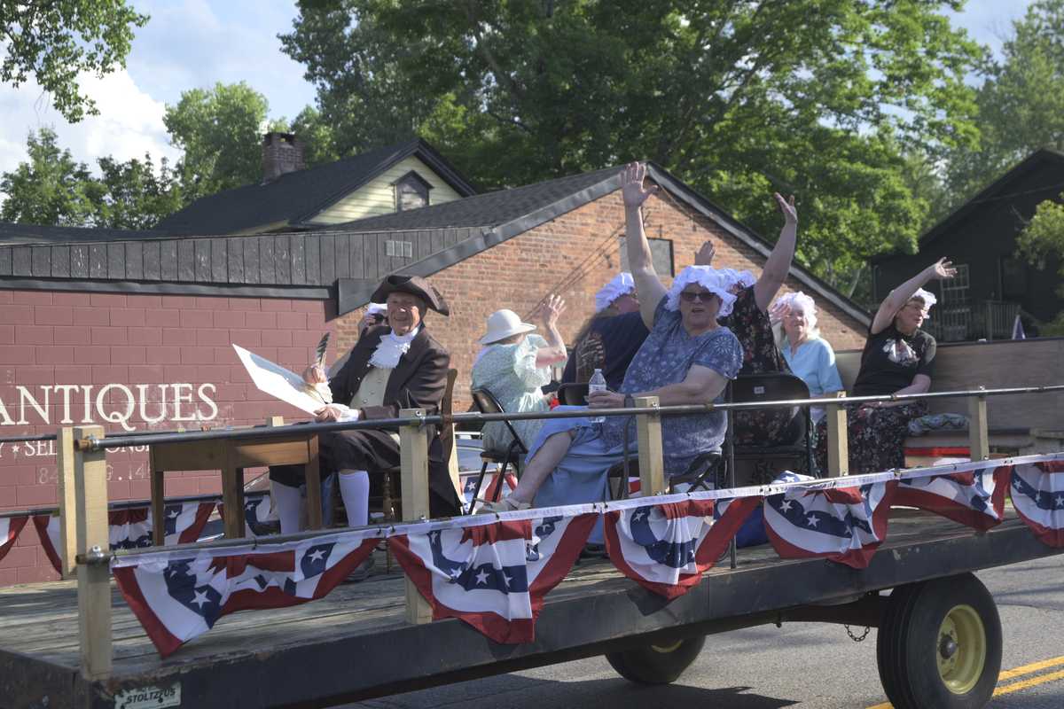
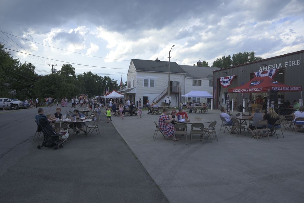
MILLERTON — Months of planning will culminate this weekend as Millerton kicks off nine days of events celebrating the village’s 175th anniversary, with festivities running from July 11 through July 19.
Lisa Hermann, a veteran festival organizer who has been leading the planning effort for Millerton 175, said the process intensified this year as the July start date crept closer.
“There’s a lot of moving parts,” Hermann said. “We’re very lucky for the volunteers we had, because we have people who live in such a small community but yet there are people with so many different backgrounds.”
The variety of expertise among Millerton’s 175 committee members lent itself to an expansive list of events spread across the nine days scheduled for the celebration. The celebration brings together local organizations, businesses and volunteers for what organizers say is one of Millerton’s largest community celebrations in years.
The celebration’s first day on Saturday, July 11, will feature the biggest lineup of distinct events. Plans for Saturday include:
Festivities continue with sports tournaments at Eddie Collins Memorial Park on Sunday, July 12. A 3-on-3 basketball tournament is set for 9:30 a.m., with sign-ups beginning at 8 a.m. Each team can register up to five players and registration costs $10 per player.
There will also be a cornhole tournament running at the park beginning at 11 a.m. Registration for that tournament begins at 10 a.m. and will carry a $30 entry fee.
Starting Saturday, July 11, and running all week are the North East Historical Society’s exhibit on Millerton’s history at the Millerton Methodist Church on Main Street. Visitors can peruse the exhibition materials between 10 a.m. and 4 p.m. from Saturday, July 11, to Sunday, July 19.
The night of Monday, July 13, will see a special dinner at the Millerton Inn, set for 4 p.m. to 9 p.m., and a free screening of “Burying the Hatchet: The Tom Quick Story,” followed by discussion at the North East Community Center starting at 6:30 p.m.
Tuesday, July 14, will mark the unveiling of a brand new outdoor classroom on the Harlem Valley Rail Trail. The immersive learning space will include vibrant, educational displays exploring water ecology, natural and social history, birds, insects and other elements of the local landscape.
On Wednesday, July 15, the Millerton Inn will host a party on its front lawn with outdoor cooking, cornhole and fire pits.
Then events start ramping back up with the Millerton Business Alliance’s annual Summer Stroll event, featuring sidewalk sales and pop-ups from local businesses throughout Millerton’s downtown from 1 p.m. to 6 p.m. The North East Historical Society’s exhibit on Millerton’s history will run from 1 p.m. to 7 to coincide with the Summer Stroll.
Festivities on Thursday wrap up with a comedy show in Eddie Collins Memorial Park hosted by local comedian and lifelong Millerton resident Ronnie Reed at 7 p.m.
The nine-day celebration then hits its apex starting Friday, July 17, with the kick-off of the Millerton 175 Fair at Eddie Collins Memorial Park. Carnival rides and games, live music, food and drink will fill the park for three days from July 17 to July 19.
The fair will run from 2 p.m. to 10 on Friday, July 17; from noon to 10 p.m. on Saturday, July 18; and from noon to 6 p.m. on Sunday, July 19.
Bands and musicians from across the Hudson Valley will take the stage to perform free concerts in the park, including Northwest Passage Band, Guilty Pleasure, Jordan Stoner, Hammerhead Horns, The Steve Dunn Trio, Last Good Bender and The Wanda Houston Project.
A children’s stage will also host performances aimed at younger members of the audience, including a musical set from Danny Tieger, onstage clowning from Bee Bee the Clown, the musical talents of Mark Rust, and Jackie the Magician to close out the fair on Sunday.
Hermann said she and the planning committee are eagerly awaiting the start of festivities this Saturday. Looking forward, Hermann said there’s hope around the village that Millerton is starting to rebuild its summer recreation programs.
She said next year’s planned completion of the pool will allow village leadership to fully staff a recreation department again, facilitating more regular community events.
“We just really haven’t had a rec department in so long because we didn’t have the infrastructure,” Hermann said. “I’m very much looking forward to when the park’s done and we have that full rec department back again.”
Lucia Landolo

The public entrance to the Dover Stone Church hiking trail sits on Thomas Whalen’s property along Route 22 in Dover Plains.
DOVER PLAINS — Dover Plains resident Thomas Whalen has reached a final settlement with the town to permanently restore public access to the Dover Stone Church hiking trail.
Whalen, who owns the property containing the only entrance to the trail, barred hikers from his land in March 2026 amid a dispute with the town over maintenance costs and safety. The closure came after the town’s license to use the trailhead — granted under a September 2024 settlement agreement, which also included a financial settlement — lapsed in October 2025 without being renewed.
The Town of Dover has now paid Whalen $200,000 total since 2024 to resolve the matter.
The new agreement is more permanent, guaranteeing the right of way indefinitely unless the town establishes another public access to the Stone Church. If that happens, Whalen said, his access point would revert to private property.
Hikers may now return to the geological landmark after the town agreed to perpetually maintain the trailhead.
The trail’s only public entrance crosses over Whalen’s property on Route 22 across from the Dover Elementary School and Freshco 22 Plaza.
Dover Town Supervisor Rich Yeno confirmed the news in a statement posted online.
“The sign is down and the entryway to the public is open once again,” Yeno said on Facebook. “I have to thank all who were involved over this very long negotiation period.”
Whalen posted signs and blocked access to the trail in April 2026 after he said the town wasn’t abiding by an agreement to maintain the trailhead and improve safety and aesthetics. He initiated a legal battle in 2018 seeking to require the town to insure and maintain the portion of the trail that crosses his land. That includes snow and ice removal, and the replacement of gravel as necessary.
Whalen’s petition was originally rejected by Dutchess County Supreme Court judges in May 2021. He then appealed the suit, resulting in an April 2024 reversal followed by a settlement approved by the Dover Town Board at their Sept. 25, 2024, meeting.
The 2024 settlement marked a year-long agreement granting public access to the trail over Whalen’s property.
With town officials agreeing to fulfill the settlement, Whalen now plans to spend time creating a peaceful and aesthetic environment at the site’s entryway. “I’m very pleased that this matter can finally be called settled,” Whalen said. “I definitely want to make the entrance a pleasing pastoral setting.”
The Stone Church is one of Dover’s most well-known historical landmarks, with hiking trails, open fields and a 30-foot waterfall inside a cave that resembles a cathedral made of rocks. The site has been a public preserve since 2004, and has been named one of the Hudson Valley’s top-10 natural attractions by Scenic Hudson.
The popular site is located near the Dover Plains Station of Metro-North’s Harlem Line.
Additional reporting provided by Graham Corrigan.

Want more of our stories on Google? Click here to make us a Preferred Source.
Millerton News

A traffic cone draws attention to a sidewalk hazard along Franklin Avenue in Millbrook on July 4, 2026. The final phase of a sidewalk-improvement project for the north sidewalk on Franklin Avenue is expected to begin by the end of the summer.
MILLBROOK — The final phase of a three year long sidewalk-improvement project on Franklin Avenue is slated to begin later this summer with funding almost in place.
The fourth and final stage covers the north side of Franklin Avenue from Friendly Lane to Front Street. According to Millbrook Mayor Peter Doro, the focal point of the project is to improve safety and compliance with the Americans with Disabilities Act. As of Tuesday morning, July 7, a detailed funding plan for the construction has yet to be announced.
“The focus of the project, and of the grant itself, is ADA accessibility, improving accessibility for the villages, handicapped, senior and other populations that need help,” Doro said.
Dutchess County awarded a grant to partially cover the construction, with local taxpayers likely to cover the rest. The bid was set for discussion at a July 8 Board of Trustees meeting, and officials expect to set the financing structure for outstanding costs shortly after.
“We’re still figuring out how we’re going to structure the rest of the financing that is needed,” Doro said.
As of press time, a clear estimate of outstanding costs was not available as village trustees had not yet approved any bids. The grant award total also had not been announced.
Doro said additional information and questions regarding finances and payment will be discussed at the July 8 meeting.
The sidewalk-improvement project is expected to be complete by the start of winter, although an exact timeline is unclear.
Not every concrete slab of the north sidewalk needs restoration, but cracks and irregular steps will be smoothed out and bricks will be replaced with concrete. Additionally, the project includes the removal of one tree along the avenue and updated, safer crosswalks, including repainting.
Residents on Franklin Avenue on Saturday, July 4, said improving the sidewalks is necessary, although they worry how much taxpayer money will be going toward the project. Some didn’t know the construction was going to be taking place.
Doro refers to Franklin Avenue and the business district as the “lifeblood of the village.” He said businesses along the north sidewalk will remain open and accessible throughout construction.
Graham Corrigan
Community cooling centers opened across Dutchess County last week as temperatures climbed into the upper 90s, prompting officials to warn residents about dangerous heat just days before the powerful July 4 storm swept through the region.
Many libraries, town halls and community facilities offer cooling center services during heatwaves, offering air-conditioned spaces, drinking water and restrooms. Temperatures reached into the triple digits in some areas of the county on Thursday, July 2, and Friday, July 3.
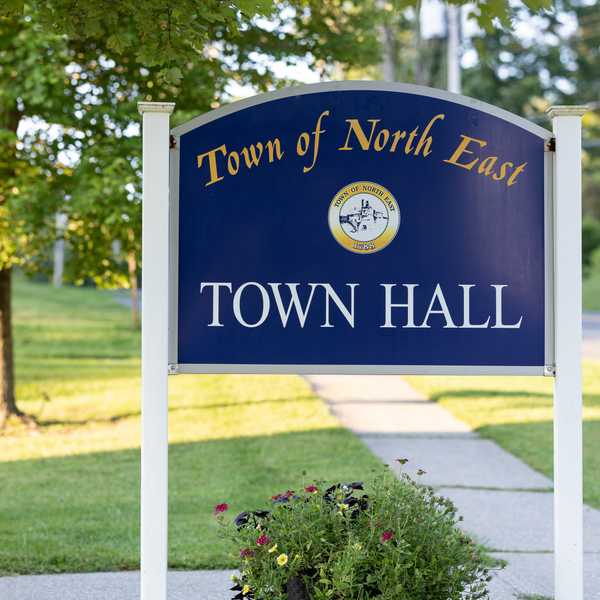
Northeast-Millerton Library, located at 28 Century Blvd., is open and air-conditioned during its normal business hours during heatwaves, offering an air conditioned space and drinking water. The North East Town Hall, at 19 N. Maple Ave., is also available during normal business hours.
The Pine Plains Community Center, located at 7775 S. Main St. above the Pine Plains Free Library, was open 24 hours a day during the last heat wave. The Free Library downstairs is open noon to 6 p.m Friday, and Town Hall, at 3284 Route 199, is open 8 a.m. to 3 p.m. on Wednesday and Thursday.
The Stanford Free Library, located at 6035 Route 82, is open Monday through Friday from 9 a.m. to 7 p.m., and Stanford’s Town Hall at 26 Town Hall Rd is available from 8 a.m. to 1 p.m. on Monday through Friday.
Extreme heat can cause dehydration and heat stroke. The heat wave last week is being blamed for at least 26 deaths across the United States. A recent report found that about 500 New York City residents die each year from heat-related illness. Residents are encouraged to remain in air-conditioned spaces or under shade whenever possible and drink plenty of water.
Graham Corrigan
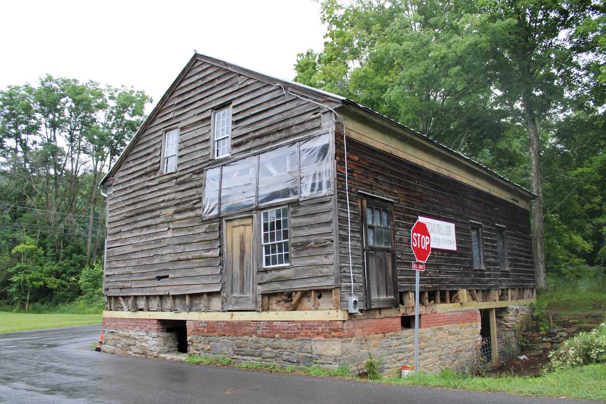
The foundation at historic Patchin’s Mill has been restored. After weeks of work clearing out the old rubble, contractors working with local preservation society Friends of Stissing Landmarks have completed a bi-leveled foundation. Stone, brick, and new timbers now secure the landmark, which dates back to the 18th century. The next step involves replacing the siding — then they’ll move on to the interiors.
The foundation at historic Patchin’s Mill has been restored. After weeks of work clearing out the old rubble, contractors working with local preservation society Friends of Stissing Landmarks have completed a bi-leveled foundation. Stone, brick, and new timbers now secure the landmark, which dates back to the 18th century. The next step involves replacing the siding — then they’ll move on to the interiors.
Want more of our stories on Google? Click here to make us a Preferred Source.
Want more of our stories on Google? Click here to make us a Preferred Source.